Biting off more than I can chew, in three countries, on a bike

Riding towards a pass we knew nothing about

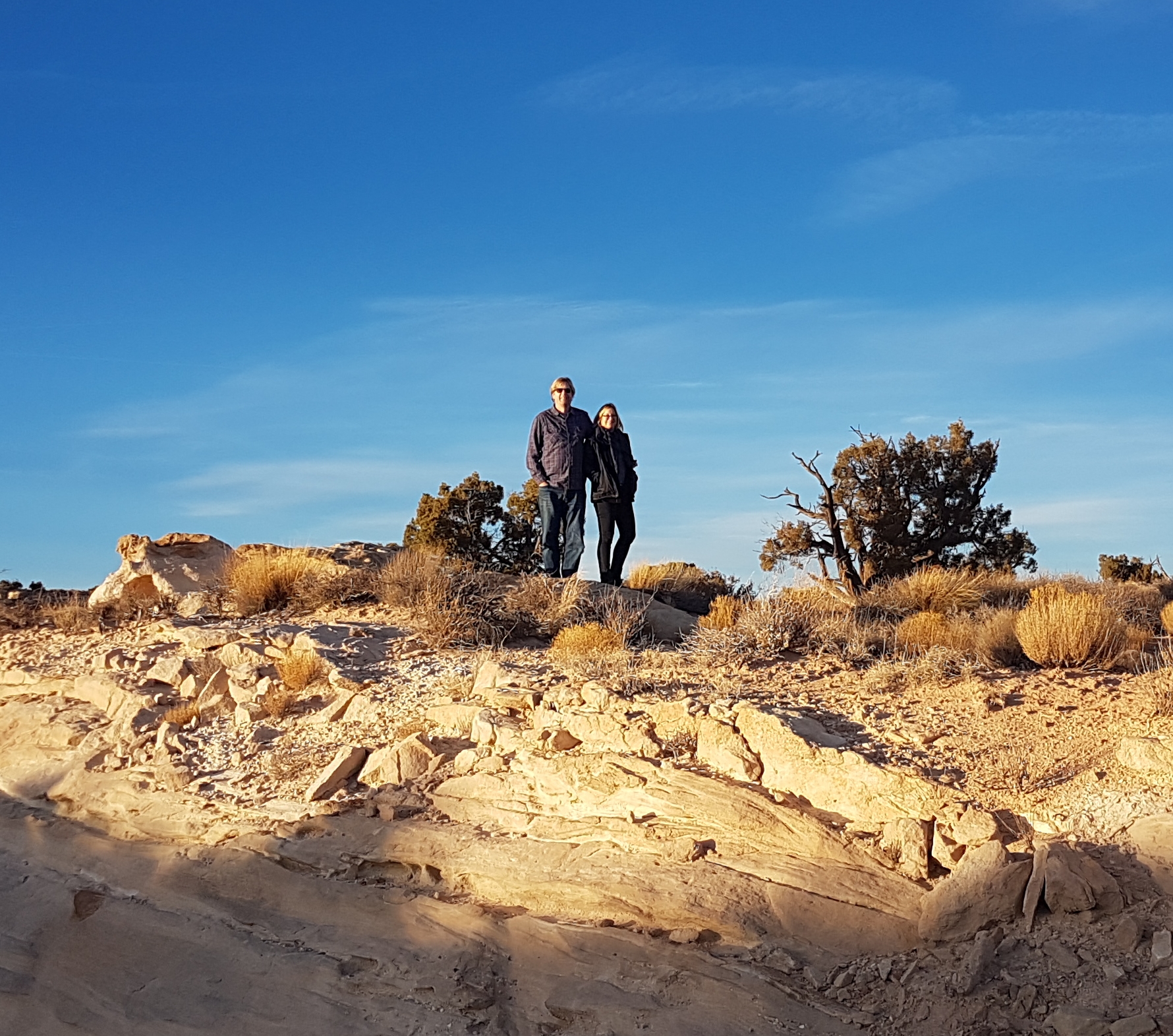
One day at the end of April, my husband Annibale (Hannibal in English) and I decided to try out cycle touring. Good for our bodies, and everyone else. There would only be some sweat oozing out of us, but no other noxious emissions.   

The problem was, of course, where to go on our bikes: forests or towns with art galore? Climb slopes or stay on the flats? Ah, an embarrassment of riches where I am plunked down, in a flat town in Veneto between the mountains and the sea.

Why not simply put it all in the hands of an app? What could go wrong? So that’s what my significant other did last spring while I was away to comfort my old dad and say hello to our newborn granddaughter. The morning after I returned, via London, where I got drunk on beer at Heathrow for lack of anything better to do during my 7-hour layover, the alarm went off and I was dragged out of bed. ‘We have to get to Austria before dark!’

I dozed on the road to Friuli-Venezia Giulia, the region east of Veneto. Venezia Giulia is the southeastern coastal spur which includes the city of Trieste, and Friuli is the rest. By the way, if you haven’t heard a thing about the latter, don’t worry. It is one of the least known parts of Italy. The same goes for Molise, the ‘region that doesn’t exist’ that my husband happens to come from (next post).

We drove in our diesel-fueled automobile to a spot which would get us closer to our destination. It wasn’t right, it was going against the whole ethos of doing things off the grid (apart from all that airplane travel…), but Komoot, our trusty digital guide, had come up with an ambitious ride for the amount of time at our disposal. We couldn’t let it down, according to the human next to me who’d actually empowered the app.

But I was game. As game as a wreck suffering from jet lag who hadn’t been on any sort of bike in months could be.

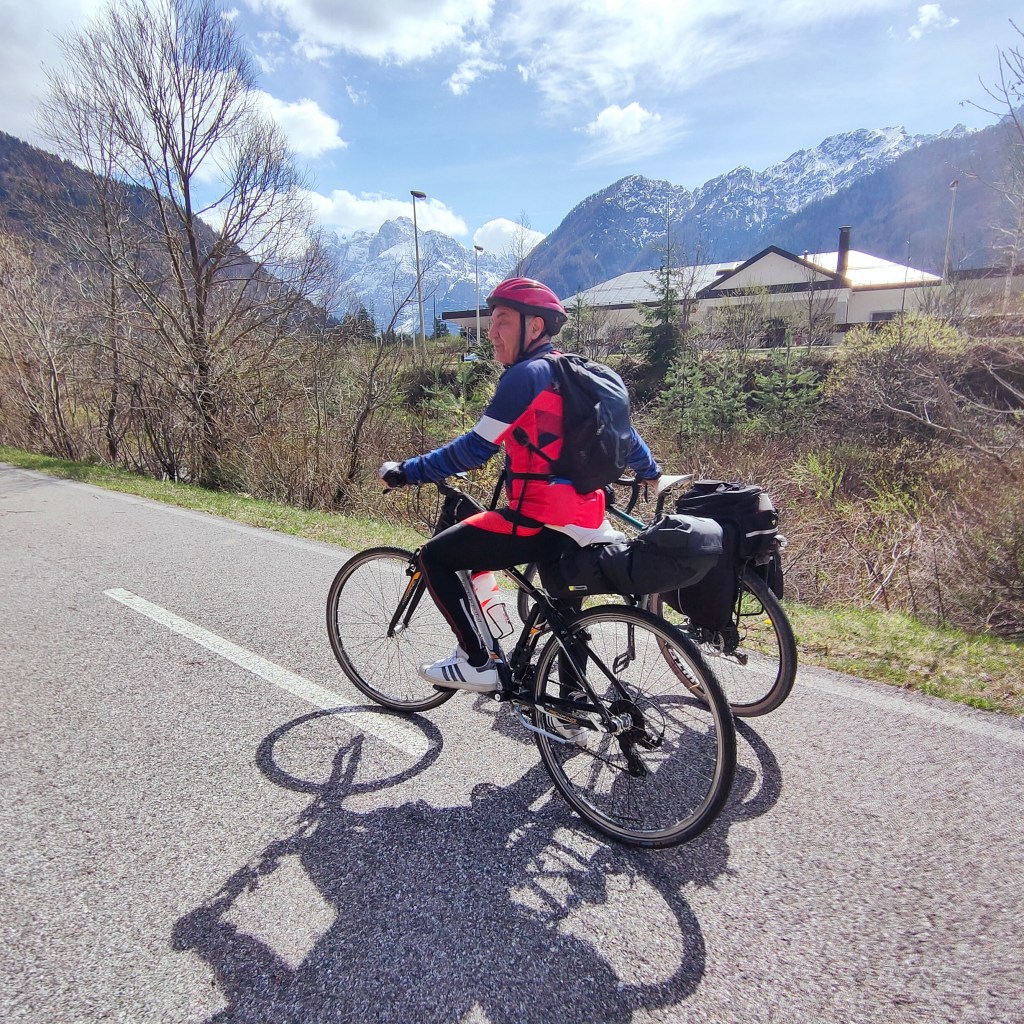
We parked in front of the Pontebba train station and headed north on a path that even my father could have handled with his walker.


Now, we were in a territory nestled between Austria and Slovenia, with some communities that still speak German and Slovenian. For this and other reasons, Friuli has a special autonomous status. That means that its local idiom, Friulano, more similar to Italian, has special status as well, and is called a language, as opposed to a lowly dialect.

Friuli produces wine, has mountains, and water flowing from the mountains, and a
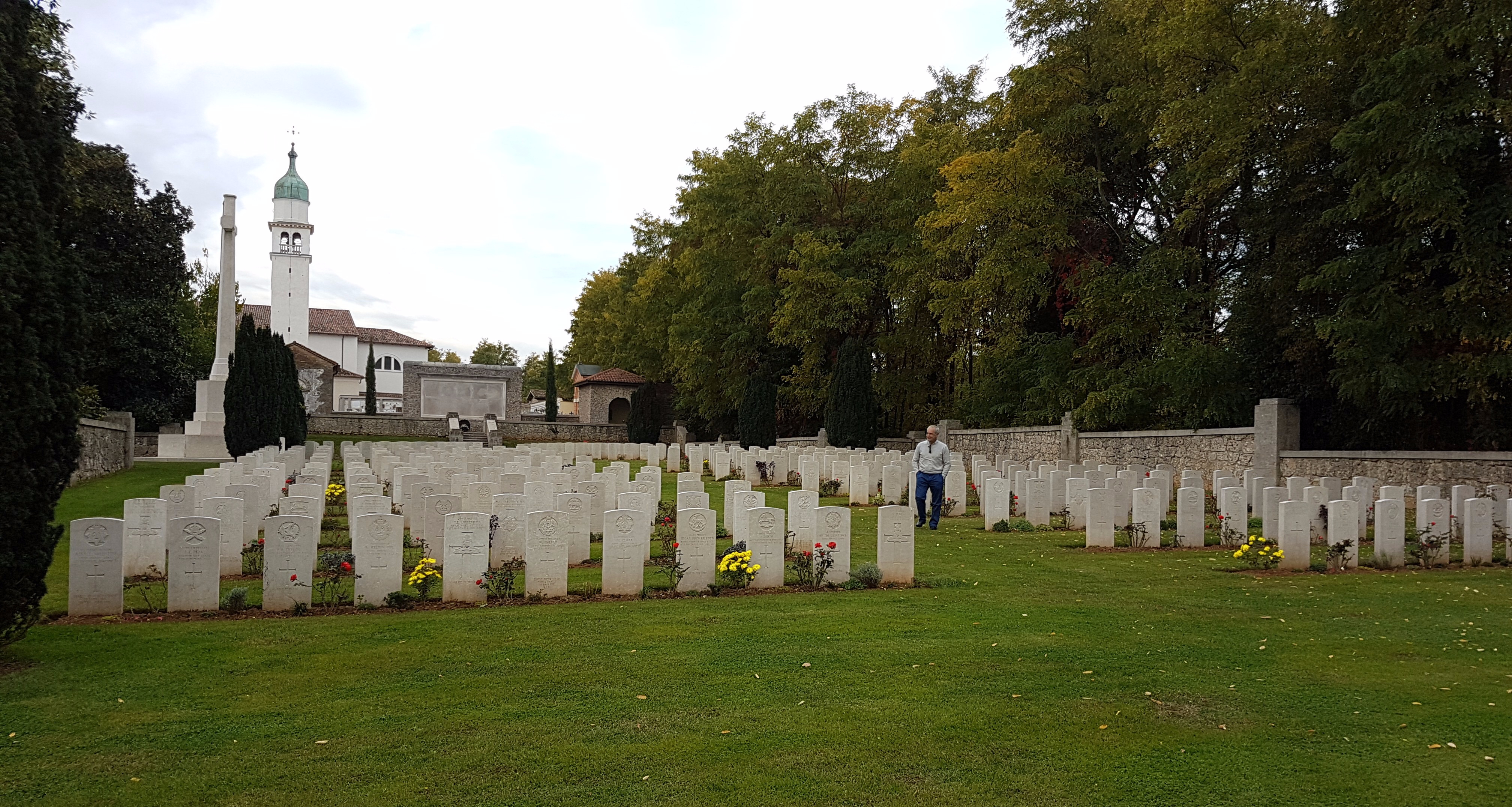
vast plain, and beautiful towns which are not very large. Sparsely populated, one could say. A frontier land that is also prone to earthquakes, alas. It also saw quite a bit of fighting in WWI between the Kingdom of Italy, and the Austro-Hungarian Empire, and its German ally.

Hemingway’s A Farewell to Arms describes the chaotic Italian retreat of 1917 from Caporetto in present-day Slovenia. My husband’s grandfathers, young men who had
hardly ever left their little hamlets in the Appennines of southern Italy, were both
swooped up and conscripted to fight in the Alps of northeastern Italy during the Great
War. Despite having been wounded in Friuli, one grandpa always talked about going back
to visit that place in the wild blue yonder where he came of age, and didn’t die.

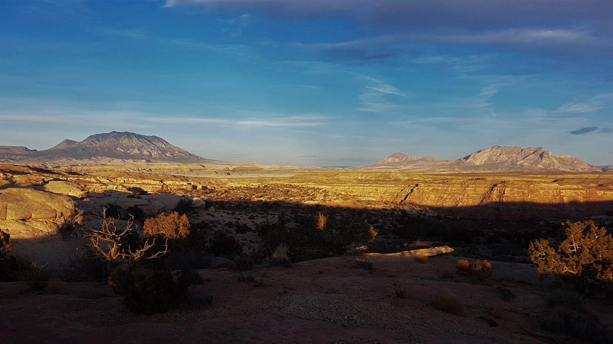
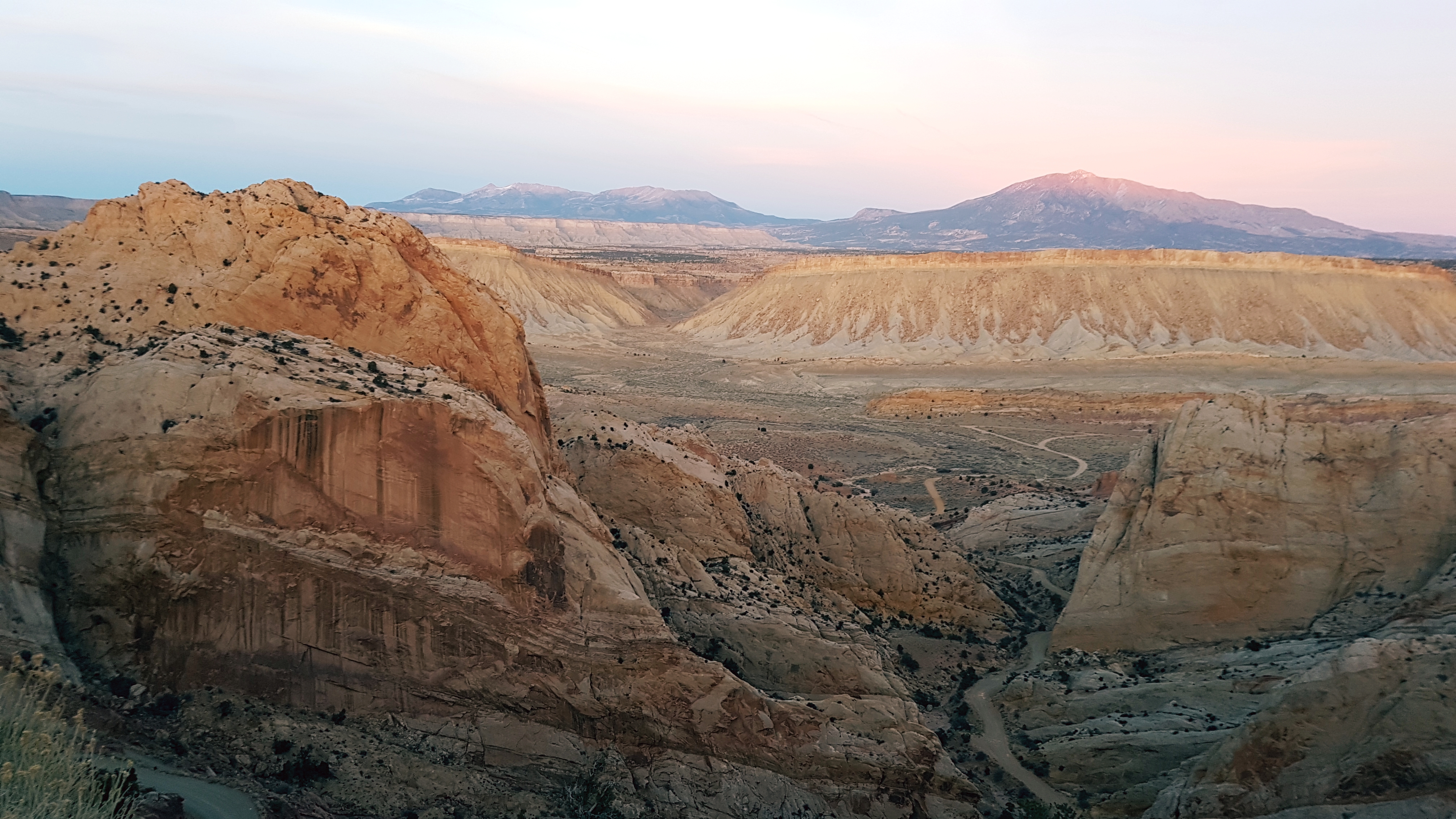
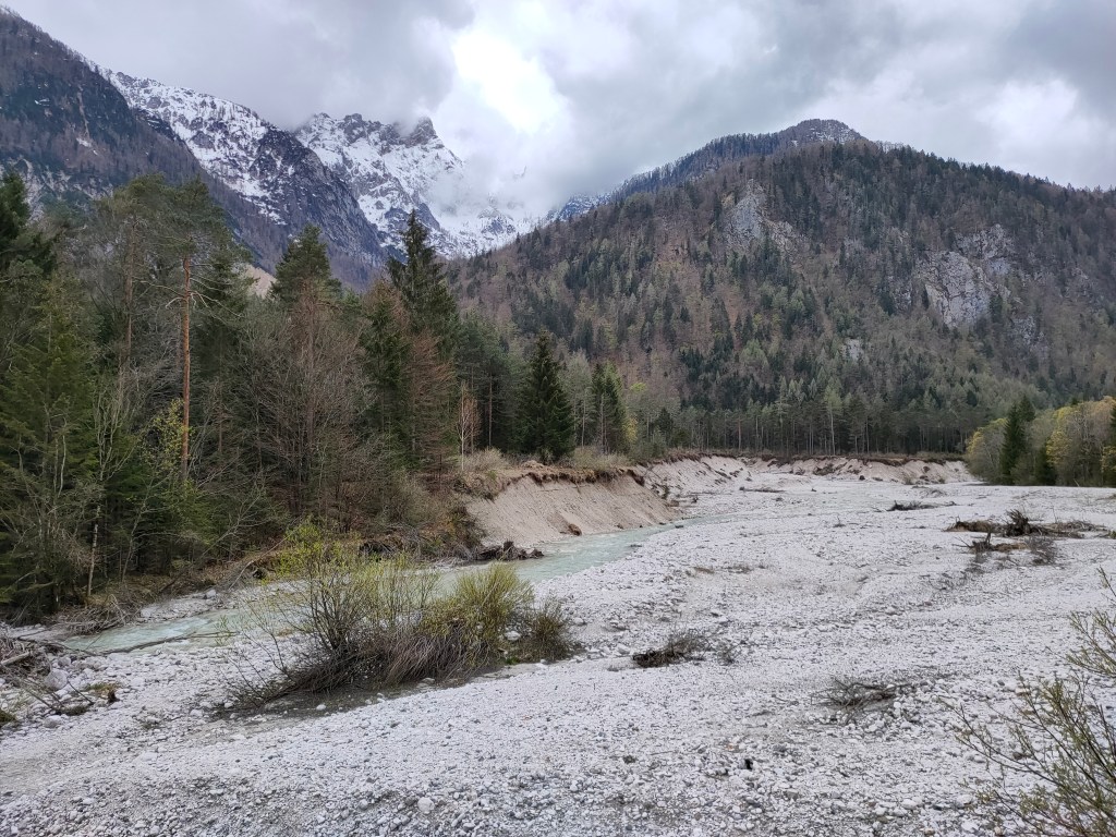
The ascent to Austria on the bike trail was so gentle that even my flabby legs didn’t feel it. And what a fine surface, set apart from the main road, with views of the river Fella below and the peaks of Carnia (northeastern Italy) and Carinthia (Karnten in southern Austria) and Carniola (Primorska and Gorenjska in northwestern Slovenia) standing in all their April splendor. You couldn’t ask for more, really.  

ascent on the forgiving Alps to Adriatic cycling path

We reached Tarvisio in no time. It lies in a land of three countries, a Dreilandereck, one of those handy German words that describe a whole situation in five or ten seconds. You can consult Mark Twain’s highly-esteemed essay The Awful German Language (https://faculty.georgetown.edu/jod/texts/twain.german.html) for more on that.

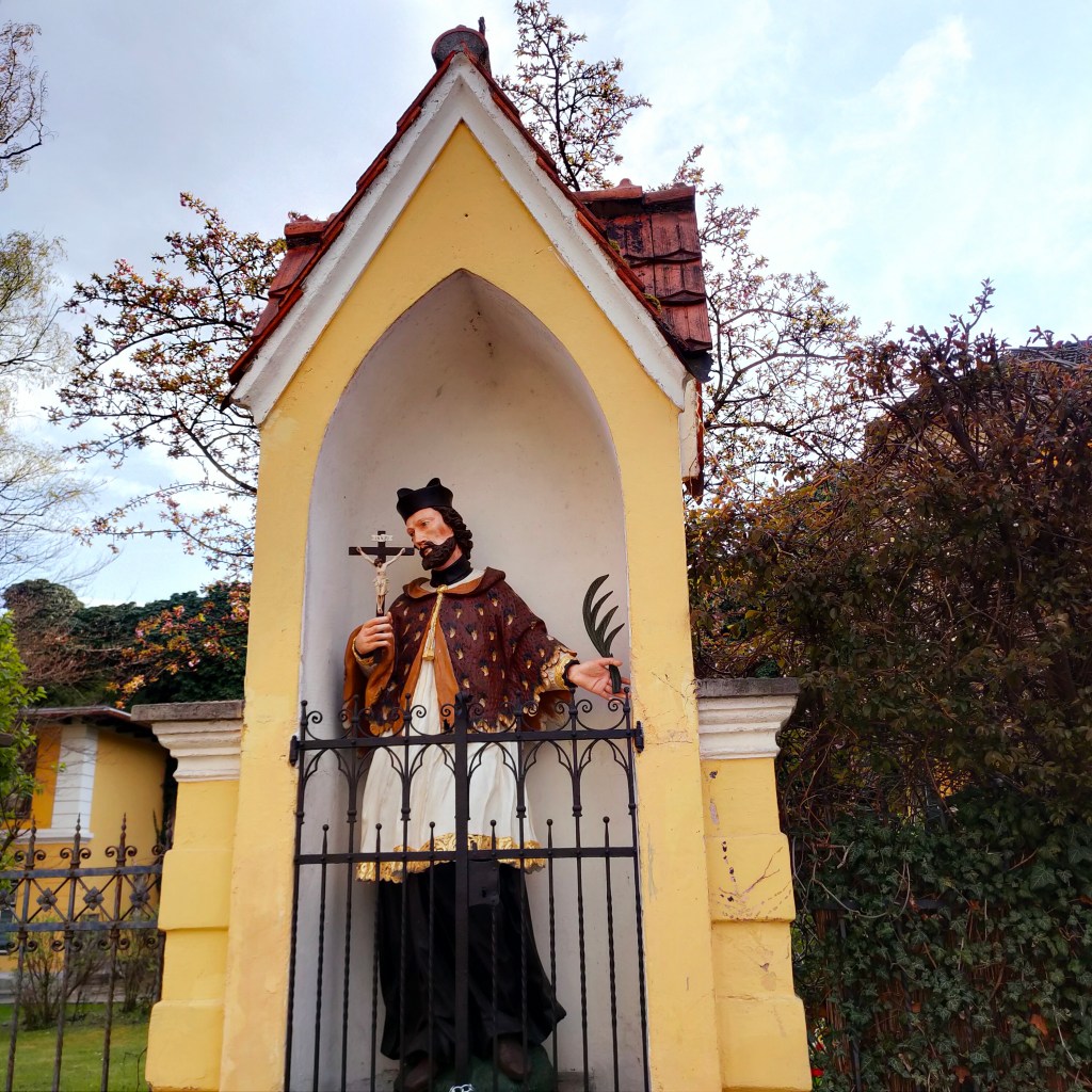
Tarvisio is famous for being in that little corner. And for having been wrested from Austro-Hungarian control during the devastating territorial war mentioned previously. Notice that the gracious sign below is written in four ways: Italian, Friuliano, German (the latter two identical here) and Slovenian.

Welcome to a border town

So far, so good. We ended up in a woody area near the extinct border between Italy and Austria, where we were following a scruffy-looking man in his late 60s with hefty panniers on both sides of his bike. He looked as if he hadn’t had the chance to take a shower lately. At a certain point a car shot out of a side road that had access to our path, forcing our cohort to make a sudden stop. ‘Asshole’, I heard the poor guy bellow. I sped up to talk to him, thinking he might be from my homeland. But no, he was a German from Bremen. Wow, I thought. Has ‘asshole’ entered the German tongue, the same way Americans say kindergarten and scheister lawyer?  Would have to ask my Teutonic colleagues about that. Full disclosure: I’ve been trying to improve my basic knowledge of the formidable German language on Duolingo as I think it’s good for my brain. No matter what Twain says. Anyway, the Bremener had cycled all the way from the North Sea to Venice and was now pedaling back. He deserved to tell the brutish automobilist off.

We were all heading for Villach, a small city in Karnten with a Slovenian name. Makes sense. The country we associate with The Blue Danube and Sissi and Sacher Torte was once part of a sprawling political entity with a whole slew of peoples and tongues. Many ethnic groups were eventually able to create their own nation-states, which didn’t necessarily include all the areas historically inhabited by them. Languages leave traces.

We crossed into Austria, where the bike path became less idyllic. We were inhaling car exhaust as we pedaled next to traffic-ridden thoroughfares in Villach, until we turned off the main route to go to an outlying village we’d chosen for a cheaper overnight stay. There we found the sort of Sound-of-Music type countryside we’d been expecting. Tidy green fields, and an understated church. And once we arrived at our modest hotel, I discovered that studying German can actually be useful, rather than simply entertaining or a way of staving off dementia. Just because English is the modern-day lingua franca doesn’t mean, of course, that everyone speaks it. Not everyone is into that kind of thing, in fact.

Back road in Austria

So I managed to understand the most crucial things, such as where the only restaurant in the entire area lay. Just a twenty-minute walk. What a relief, as our loaded gravel bikes needed a rest for the day.

I was also lucky enough to have studied, on my app, all about the love of German-speaking people for white asparagus. A goodly vegetable, full of nutrients. But what makes it so extraordinary? I reminisced about a corn-on-the-cob festival in Wisconsin I went to as child. There was a feature where you could pay five bucks for as many cobs as you could knaw on in 15 minutes. I’m sure swallowing small slices of pale slender stalks cooked in different ways is much more elegant. And therefore makes people go wild with delight, somehow.

White asparagus non-vegetarian specialty

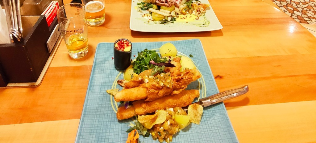
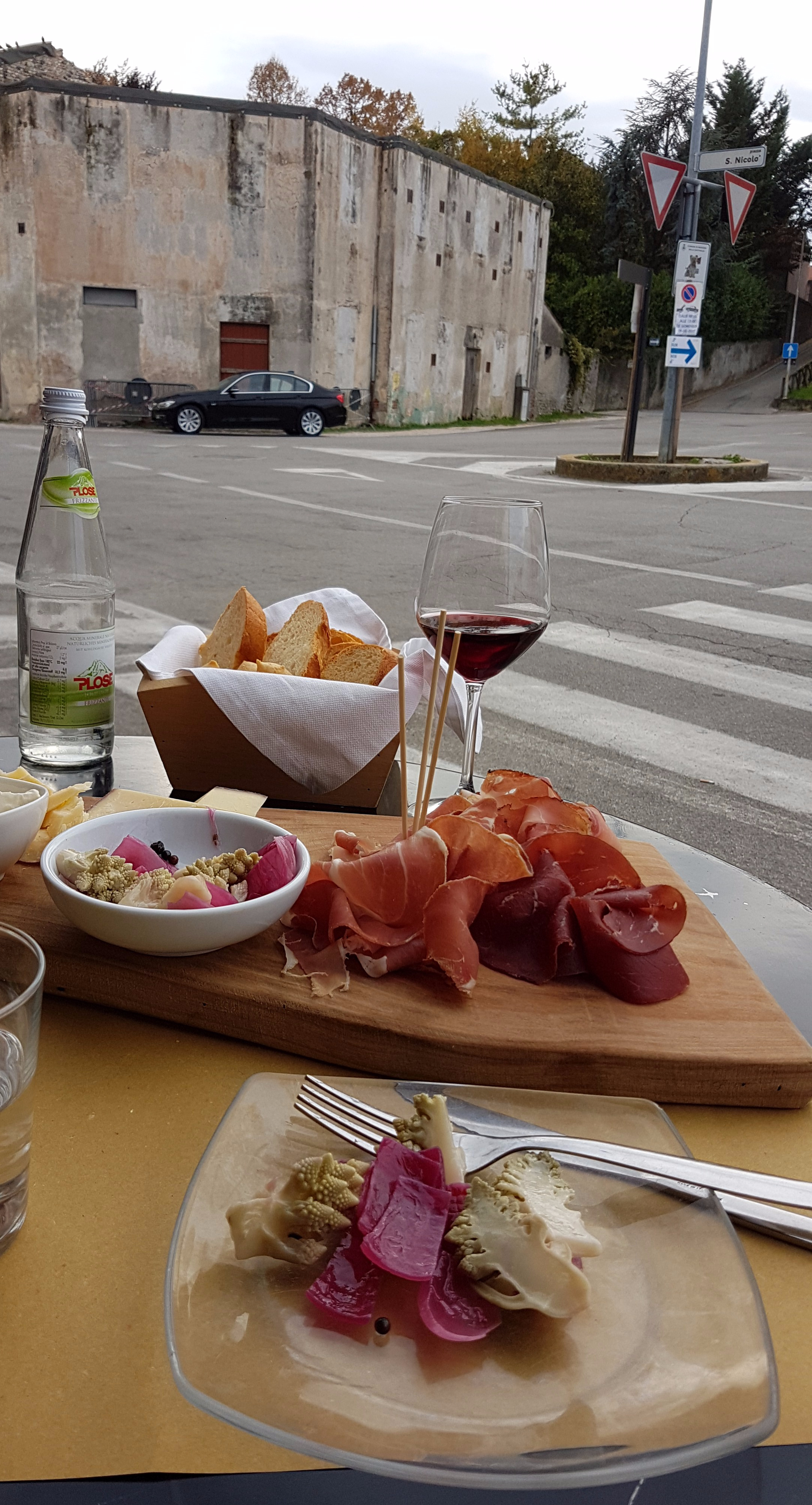
In any case, all the lessons about the famous Spargel turned out to have a purpose. They gave me a heads-up on why the local gasthof had an entire menu dedicated to this wondrous vegetable. Deep-fried asparagus wrapped in bacon may not be particularly healthy, but it did go down the hatch quite easily (along with some more beer).

Back in our room under my eiderdown, still suffering from jet-lag, I pulled out the reading material that I’d stuffed into my case. A slim paperback in lieu of an extra pair of socks. Wunschloses Ungluck, by the Nobel Prize winner Peter Handke. Difficult to swim through, but not because of its style or unbearable title (translated as A Sorrow beyond Dreams, although I would label it Dreamless Misery. But my German is execrable, so what do I know?). I was simply biting off more than I could chew. It’s a bad habit of mine which I still haven’t rid myself of. Now, I knew the ending was bad – the author’s mother was going to kill herself – but it was something a friend had once given me, it had been sitting on a shelf, neglected for twenty-some years, and it took place in Karnten. I opened it to the first page.

It turned out that Handke’s maternal grandfather was of Slovenian descent and was the first of his line to actually own property and thus be rich enough to marry. His forebears were farm laborers who procreated without the luxury of becoming husbands. I thought of my own great-great-grandfather in Sweden, who did marry, it’s true, but was also landless and so poor he had to live ‘on the parish’ – 19th century Scandinavian welfare. Some of his nine children, including my great-grandmother Nina, emigrated to America to escape that fate. I then nodded off before I could get much further than understanding that women living in rural Carinthia in the early 20th century weren’t supposed to expect much out of life. Their lot was to have a few laughs before the grim reality of marriage, children, cooking, and death.

We cycled eastward the next day. An easy ride along the Worthersee, a long lake surrounded by hills. Ah, I was in better condition than I thought. This was a bed of roses.

Calm, restful Worthersee

We passed through Klagenfurt, the busy capital of the region, had coffee, and turned north, just to put in a few more kilometres. All quite leisurely. And it turns out this is known as the sunniest part of Austria! Handke might disagree with that appellation, however. One of his sentences I actually understood without a dictionary focused on endless days of rain and fog.

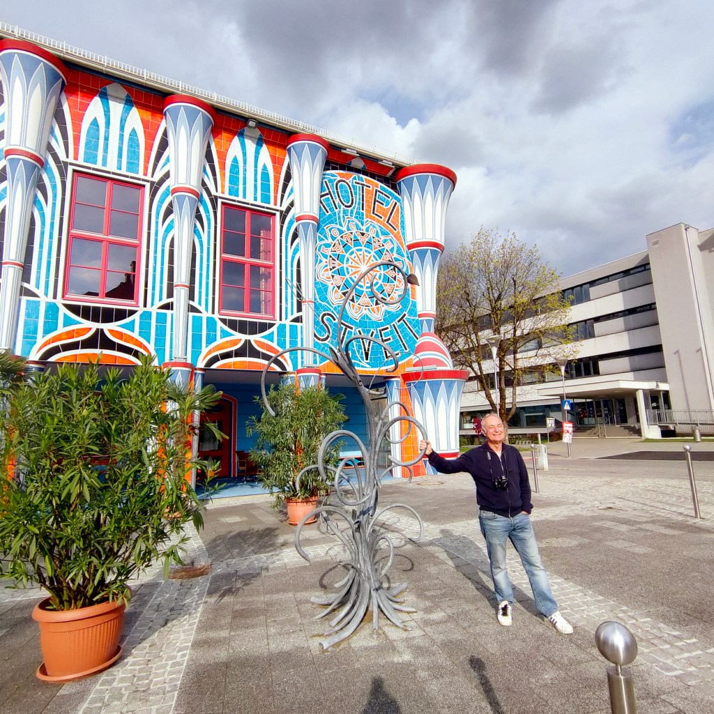
Only a little bit of grayness for us, though. We made our way up to Sankt Veit an der Glan and stayed in a fantastically decorated hotel. Austria is also known for art and design. Think of Schiele, Klimt and Hundertwasser.

Exuberant facade
Sankt Veit himself, with his own exuberance

That night at dinner, over beer, my husband mumbled something about the road ahead. He was a little worried about the third day’s route, which would take us south over the Karawanks mountain chain into Slovenia. ‘It might be a bit steep,’ he said sheepishly, as he ate some more Spargel. Grilled this time, with sausage on the side. ‘Steep’? I was having trouble understanding him with all the noise from the other ecstatic spargel diners around us. ‘Yes, and it might rain too…it turns out…’. ‘Do we have any alternative?’ I shouted above the din.

I continued with Wunschloses Ungluck in our trendy little room. I would go through entire paragraphs where I might make out two words. So much for English and German both being germanic languages. The Normans did English such a big favor by coming over the channel and forcing their more worldly French on the provincial Anglo-Saxons. Just think what we’d be left with if they hadn’t.

Handke’s mother had gotten away from her family farm and started working in a hotel, just before the Anschluss (the German annexation of Austria in 1938). Then the war started and she got pregnant, by a German she loved, but who was already married. Then she in turn married a man she didn’t love, just to give her son a father. The misery was starting, although she didn’t realize it right away. They went to Berlin.

‘This will be a real test for us,’ Hannibal warned me as we packed the next day. Not difficult as I hadn’t brought much. I did make sure our cheap ponchos, all of 2.5 euros a piece, were on top. But why did hubbie have such a furrowed brow?

Crossing the Drau/Drava (flows from Sud Tirol/Alto Adige in Italy into the Danube at Osijek, Croatia)

We could see, once we reached the river, that that the landscape was changing. So much the better. We needed a challenge. We stopped to have a little sandwich in Ferlach, at which point we were already halfway to Lake Bled in Slovenia. All was well.

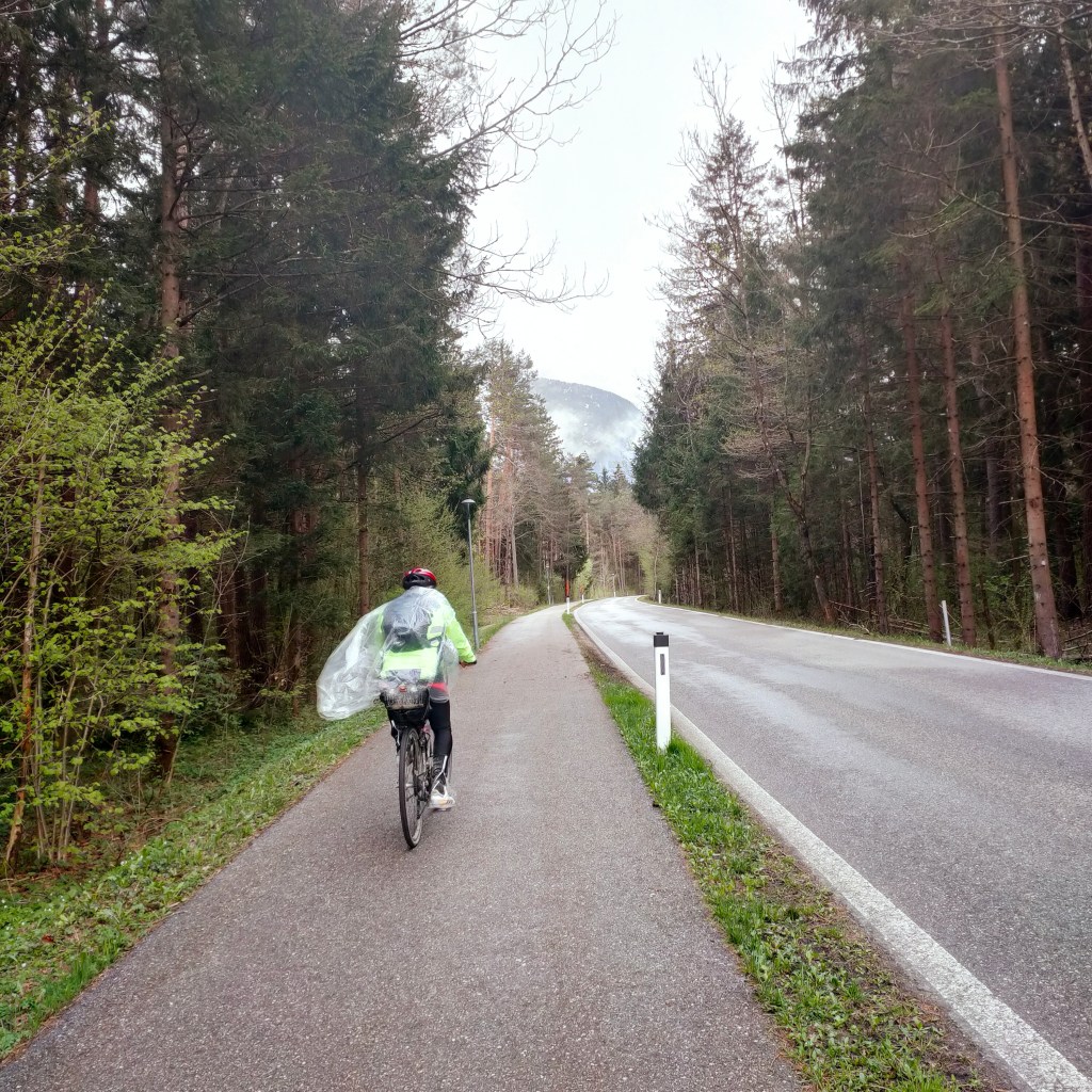
We then started on the forest road, and felt the first sprinkles of rain. The weather was starting. Time for to whip out our featherweight protective gear.

Loose fit

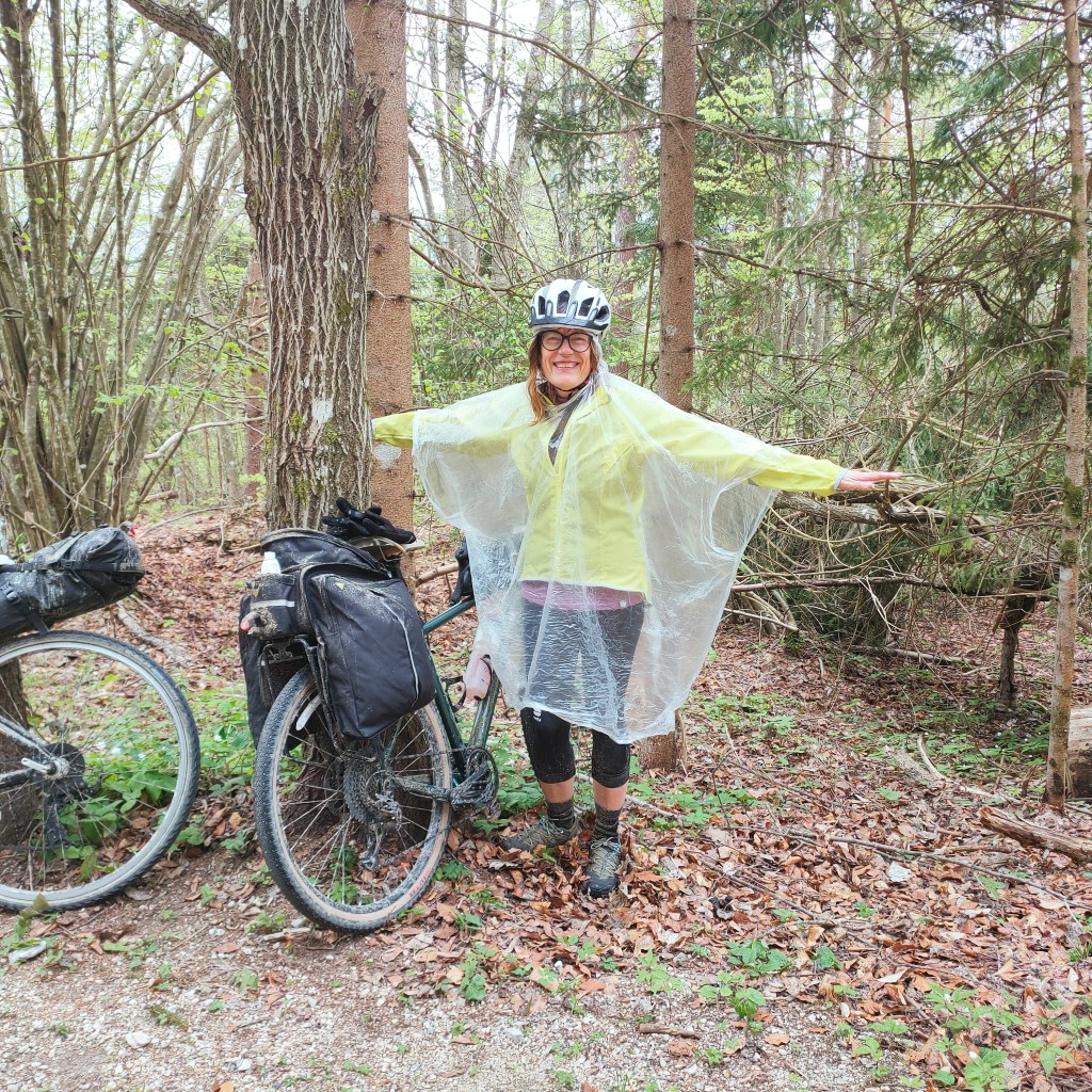
We came around a bend and an Austrian woman called out to my husband in German, telling him he looked like an angel! The transparent plastic we were swathed in, lifted by the breeze into wings, did give us an odd aura. The last time someone likened Hannibal to a heavenly creature was when we lived in Rome. Not a city where pedestrians are king. My husband stopped his car to let a tour guide lead her group of aging sightseers over a crosswalk near the Colosseum. The guide came up to his window to confer angelic status on him right then and there. She’d been standing on the curb for twenty minutes waiting for another driver to obey the law, or simply show some kindness. Hannibal was engaging in the latter behavior, she understood.

I was brought back to the present by a sudden realization that I was suffering. We were now on the main ascent to the Loibl-Ljubelj Pass between Austria and Slovenia. My gravel bike seemed to weigh twice as much as before. And my brand new bikepack, which slid onto a plastic rack behind my seat, felt as it were made of cement.

I couldn’t get up all of the tough bits (some at 15%). My husband’s bike having less sophisticated gears than mine meant that he had to jump off his even more often and simply push it up the bad parts. I found that getting off was just as bad as sitting on my increasingly painful seat. I also didn’t have the arm muscles to push or drag a loaded set of wheels up a hill. And the air-filled ponchos were useless. We were bedraggled angels halfway up.

Then we passed by a sign indicating a KZ Gedankstatte Mauthausen. I stopped to think about what that meant. Mauthausen was an infamous Nazi concentration camp in another part of Austria. But there had been a branch here too, apparently. The memorial didn’t seem to be open, though, and I didn’t have a good internet connection on my phone. So we continued going up the main road, at our very slow pace, until we reached a tunnel. A long one, it turned out, over 1.5 kilometres long, and narrow. We cycled on the equally narrow raised sidewalk which consisted of vertical slabs of cement placed next to each other. I kept imagining my tire getting stuck in the slit between the slabs and me being hurtled into the lane full of traffic to my left. I wouldn’t recommend that particular route to anyone. It’s probably illegal for cyclists, as a matter of fact. Not that that had stopped us, not on Komoot.

Once I did have a good connection, later in the day, I found out that the tunnel itself was infamous. It was actually built by prisoners from the local branch of the Mauthausen camp during WWII, some of whom died while constructing it or were executed in northern Austria when they could no longer work. A few survived and walked through the tunnel to Yugoslavia at the end of the war (Slovenia became an independent country in 1992, after having been part of the southern Slav nation-federation of Yugoslavia since 1918).

Every country has its history. Some worse than others. And some events are in the more distant past but others still too recent, and shocking, and shocking also because they are recent, to ignore. Haven’t human beings evolved at all? I think of the plaques I now see in the US reminding people of massacres and lynchings that took place in pretty spots in Virginia, for example, before and long after the end of slavery. And Austria is, in fact, the birthplace of Schnitzler, Freud, and Hitler.

Here is some more information about this particular site: https://www.mauthausen-memorial.org/en/Loibl/The-Concentration-Camp-Loibl

We made it out of the harrowing tunnel, and found ourselves in Slovenia. On a saddle in the Karawanks/Karavanke (a mountain chain in the Southern Limestone Alps, which include the Dolomites). There was still a bit of snow higher up. I turned to my husband and told him that although we were utterly exhausted, we weren’t actually soaked. Only light precipitation in Karnten, after all. No sooner had the words popped out of my mouth than the heavens opened up and drenched us with an icy downpour. I took off down the busy highway without further ado. I paid no attention to the cars and trucks I was racing alongside or the floating sheets of water on the road.

In Slovenia, on the southern side of the Loibl Tunnel

I got to the bottom of the hill first. But where was my companion, usually so much faster than me? He caught up five minutes later, aghast at the risks I’d taken. ‘You could have been killed!’

I explained that I had lost my powers of reasoning. I just wanted to get to our hotel room in Lake Bled, the inauspitious-sounding Bled. A famous spa town in northern Slovenia on the shores of a lake with an steeple-topped island in the middle, surrounded by hills, that doesn’t have anything to do with bleeding. Still…

‘We somehow missed the track that Komoot suggested! It’s back up there!’ I glanced up at the top of the slope. Unthinkable. And I hadn’t seen any sign of an opening on my way down. My husband showed me, once we’d found a bus stop with a roof, and he was able to wipe the screen of his phone dry, that he was referrring to a steep rocky path with boulders that would have taken us up to another saddle, from which we have been catapulted down into the next valley. A fearsome short-cut that we might have trouble even finding in a storm. ‘We’d have to drag our bikes up that,’ Hannibal explained. ‘And drag them down, too,’ I whispered.

I explained that my crotch was on fire and that I was probably suffering from hypothermia.

So we checked our map again and decided to cut westward across the countryside to Bled to avoid the main thoroughfares. The route also looked slightly shorter.

It wasn’t raining quite so much, and the road we’d chosen was lovely. Meadows and fields and little stands of trees in their seasonal shade of light green. I would’ve taken many pictures at any other time. An ascent to each little town, and a descent before the ascent to the next one. Up hill and down hill, over and over and over. All those clusters of houses that had to protect themselves from marauders in the Middle Ages were serviced by our byway. So unbelievably charming. My leg muscles were inflamed and my head was spinning.

Rule of thumb: Always bring extra footwear

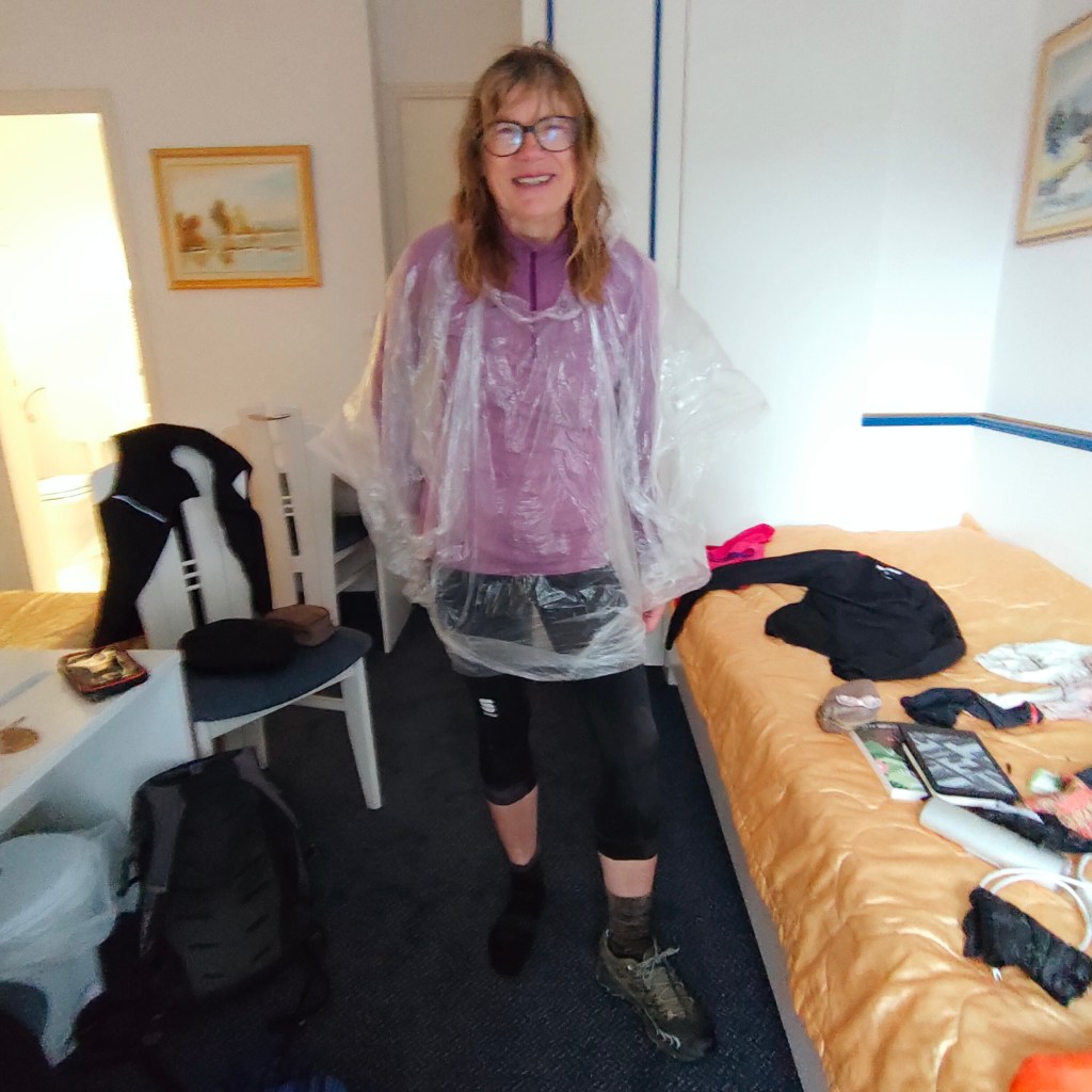
We finally reached the outskirts of Bled, at which point there was even a bit of bleeding going on. Never mind. We found our hotel and I fell off my bike. I hung on to the bannister to get up the staircase to our cold room. There I discovered that my new bike case and bags weren’t waterproof! I squeezed the water out of my shoes, warmed my hands over the tepid radiator and hobbled across the street to a gostilna where we each had a plateful of wienerschnitzel. My husband told me I was heroic. I said that I was just plain clueless. It was actually the most grueling workout I remembered ever doing in my whole life. The combination of no conditioning, bad clothing, and not knowing the route was downright foolish. I had bitten off too much, once again.

And to continue in that trend, I turned back to my book. What happened next to Handke’s mother?

She and her German husband got out of East Berlin in 1948. She used her Slovenian to talk to a Russian guard at the border crossing. The family ended up back on the farm in Karnten, where she had more children, and also performed abortions on herself. Her husband would get drunk during the winter when there was nothing to do, and beat her up. She was curious, she started reading books. I fell asleep.

We took one picture of the truly lovely lake most people come to for a relaxing sauna. But no time for dawdling. We had to get back to Italy.

View of Lake Bled, Slovenia

Our app then sent us on an adventurous route to get up to the northern valley of Kranjska Gora.

Komoot, as far as I understand, was created by a bunch of young men who weren’t too worried about things like safety, private property and so on. They just want their users to get to places as fast as possible. And Annibale delights in doing illegal things he knows he can get away with. He swears that this is his Italianness.

Our app assumed we had good tires

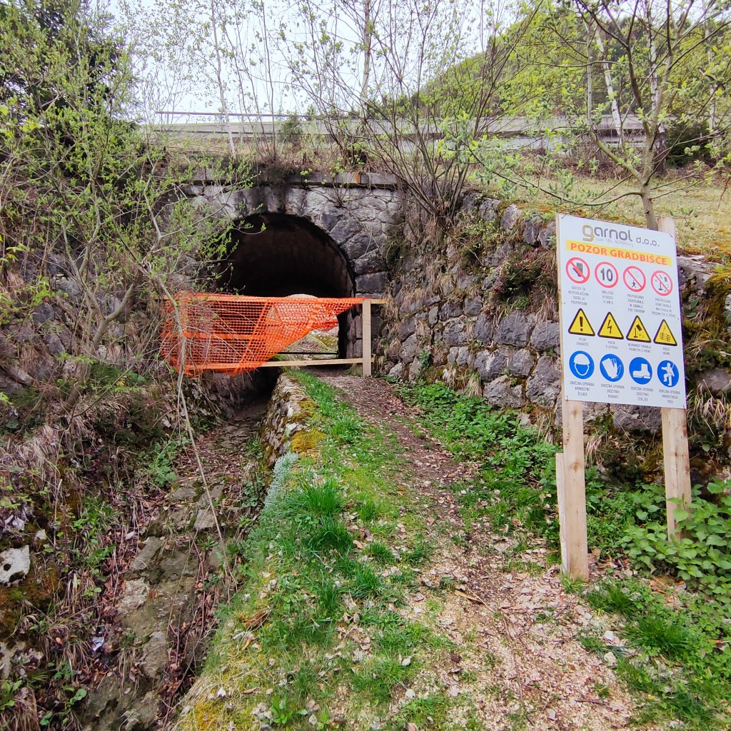
At a certain point, we were told to ride under a bridge on an informal sort of road, and then rumble along in the deep trough of a railway under construction. And then through a tunnel undergoing repairs under a railway that was actually functioning. Tiring, but also so much fun! Breaking rules has that effect on people, apparently.

No need to translate

Our off-track biking did get us to where we wanted to go while bypassing some busy roads. We ended up east of Kranjska Gora, a ski resort in northern Slovenia located on a side spur of the same Adriatic-Alps bike trail we’d taken from Pontebba. We knew that our troubles were over.

Riding westward towards Italy
A typical European Union border

The path to Italy was wonderfully paved, just like the entire Adriatic-Alps route. Smooth sailing, which was just as well, because I could no longer sit on my saddle. I stood on my pedals and let gravity take me back to the car.

Limestone blue in the Fusine lakes

We did stop to look at the karst Fusine area, just inside the Italian border. Karst, by the way, refers to a landscape full of underground rivers and sinkholes and caves and such caused by its limestone base. It comes from the German name given to the rocky plateau overlooking Trieste, which is also called Carso in Italian, and Kras in Slovenian.

I got home and continued to read my book as I recovered from our trip. I reached the bitter end, not sure I’d actually understood what the son thought about his mother’s decision to end her life. Was he proud of her, did I get that part right? I’d have to start over, I decided. I would be going back to Austria, and I would continue working on the challenging German language.

I also needed to be more constant about my cycling, to make my excursions less dramatic. The Loibl/Ljubelj Pass isn’t even all that difficult, compared to many others that I have done myself. https://climbfinder.com/en/climbs/loiblpass-ljubelj-ferlach

And I had to look for a book by a Slovenian author for my next trip to a small country full of mountains, rivers, caves, and bicycles. But not in Slovenian. Not yet.

Getting religious in southern Utah

Boulder

20171230_161937
Birds hanging out in downtown Boulder at sunset

Last December, my brother Will and I took my father, who now has serious trouble walking and resides in an assisted living facility in Austin, Texas, to Utah. The aim was to meet up with some of his longtime friends, mostly members of the Sierra Club, who are infatuated with the Colorado Plateau. These pals and comrades-in-arms have been gathering in a tiny hamlet to ring in the New Year for decades.

20171230_163728
My father checking out bygone prices

Boulder, Utah. Where the heck is that, you might say? Well, you’d be forgiven for your ignorance and yet you would probably want to know more, because it’s a pretty far-out place in many ways. For one thing, it’s in the middle of the southern part of the state of Utah. The big, weird rocks and utter loneliness of the whole area have such an effect on people that I understand my brother when he calls it ‘the church of southern Utah.’ Being there is, in fact, like going to church, in the best sense of the term. You feel reverant and somehow purged of all bad feelings by its mystery, minus the mumbo-jumbo.

20171229_171553
Waterpocket Fold

Now Boulder is supposedly the last town in the lower 48 states to receive mail by mule. The poor mules walked along a scenic trail which some of them apparently fell off from time to time.

20171230_141014
Boulder Mail Trail

Their service to the community ended in the 1930s, when the federal Civilian Conservation Corps finished a gravel road connecting the two metropolises of Boulder, population 266, and Escalante, pop. 878, further to the south. This circuitous link, which goes up and around and down, is called Hell’s Backbone and is kind of a wild ride, too, as the name implies. Most drivers these days would prefer Highway 12 from Escalante or Torrey, to the north. But another possibility is the semi-paved Burr Trail that comes in from the east, and that’s what my brother decided to take to get our father to Boulder for New Year’s Eve.


20171229_164507
Looking eastward from Burr Trail

When I was a teenager in Salt Lake City, I did some backpacking in the canyons of the Escalante (the last river to receive an official name in the lower 48) and its tributaries, including a lovely place called Death Hollow. It may have gotten its name from the long-suffering mules falling into it. It is truly lovely, though. And those trips changed my attitude towards a state I was new to and not getting along with very well. That church of southern Utah experience came over me, and I realized there was something sort of magical down there in those fissures and streambeds and rocks.

I then moved away from the West, and didn’t go back to that part of the state until after Clinton created the Grand Staircase/Escalante National Monument. That seemed like a wondrous thing. Extraordinary land protected forever. Until the end of time. That was the reasoning behind the designation of the first national monument, Devil’s Tower in Wyoming, in 1906. It was supposed to go on like that, forever!


20171230_132417
Grand Staircase/Escalante

But as my father loves to say, after Chaucer, “all good things must come to an end.” I guess that is true, but don’t know it should be so. In any case, the US has had its ups and downs as a country. For example, the bit about the end of time, wasn’t that what the government said to Native Americans over and over? In the 1868 treaty with the Sioux, the Indians were promised the Black Hills of South Dakota forever and ever, until the end of the world. I remember reading that somewhere, maybe in a museum. But the agreement, signed and sealed, only lasted until the next gold rush.

20171230_131636
My brother Will enjoying winter landscape (Grand Staircase/Escalante)


We know, in fact, that the US has not seen the end of the gilded eras of robber barons, blatant and tolerated corruption and total lack of respect for treaties and people’s rights,etc.  Our current president, who doesn’t like exercise and knows nothing about natural beauty, has declared that the monument lands of Grand Staircase/Escalante and Bear’s Ears, created by Obama at the request of five local Native American tribes, have now been reduced by half and 85% respectively. This is to open up these places to oil and coal development and save them from being overprotected for the general public. The general public, ordinary people who like walking, in goobledygook language, have been referred to as ‘special interests.’


20171229_144532
Bear’s Ears from highway 95

Well, when we, my brother, sister-in-law and father, came into southeastern Utah on December 30th (from New Mexico via a tiny piece of Colorado) we drove past the southern end of Bears Ears on state highway 95, a road that doesn’t get much traffic in the winter. We crossed paths with one car on the 90 some miles to the Hite Bridge over the Colorado river. We had a schedule to stick to but I couldn’t help gawking. Bears Ears is sacred to the Navajo, Hopi, Zuni and Ute peoples and is chock full of well-preserved artefacts from ancient dwellings going back over 10,000 years. Not to mention an incredible trove of Triassic fossils.

20171229_145512
Westward-ho along highway 95

But most of that has to go, to allow coal mining or oil drilling to boost the local economy, say local politicians, Secretary of the Interior Zinke and Trump. They think nothing of tearing up places that are akin to Mayan temples or the Vatican. I shook my head. Surely there had to be a way to save all of this fantastic land from fly-by-night activities.

20171229_152246
Looking southward near Hite

We reached the Colorado, crossed the striking white bridge at Hite and then went over the Dirty Devil river soon afterwards. This is the northernmost point of Lake Powell, the reservoir created by the Glen Canyon Dam on the Colorado. The lake is receding and what we saw below us was unnavigable. We stopped to take pictures and I let my old dad out of the car to stretch his numb legs

20171229_2238302-e1520180209796.jpg
Standing tall at Hite Viewpoint

Then we piled back in to continue our drive over to highway 276, which we turned off of just before Lake Powell’s Bullfrog Marina to get onto the Burr Trail. I had never traveled on this particular route before and was wondering why that was so. How could I have missed it? But here we were, at last, on a perfect day in the dead of winter. It’s 67 miles to Boulder and the only sign of humans or development that we encountered, apart from what we were rumbling on, were two gung-ho cyclists and some cows grazing in the southern end of Capitol Reef National Park. No towns, no farms, no houses, no telephone poles, electrical lines, no nothing except for mountains, plateaus, escarpments and canyons. All of that overwhelms you, and also makes you feel thirsty for water, even when it’s cold. No country for unprepared people, that’s for sure.


20171229_161920
Who wants highways? Shortcut to Boulder on Burr Trail

The Henry Mountains (last peaks to be named in the lower 48) appeared off to the east, and the Waterpocket Fold to the west. Capitol Reef was due north.

20171229_223626
My brother and sister-in-law Mia feeling reverent along Burr Trail

At a certain point, we went up over the Fold, which looked as if some gods were messing around and started hurtling slabs of rock into a line of clay. The pieces then got stuck every whichway. That seemed about as plausible an explanation as anything else. What the heck. We all did a lot of gaping and picture snapping and sighing. If we’d lingered a little bit longer, with some alcohol, we might have started speaking in tongues or something.


20171229_225448
Henry Mountains from top of Waterpocket Fold

Our party reached Boulder just after sundown and joined my parents’ old friends at one of their homes. I found a calendar there with pictures of reunions from bygone years, including one with my mother in it. I touched her face. She was gone, but her spirit was here with these people. She had fought the good fight for air quality and preservation of public lands. She also liked Boulder. I remember when she was thinking of selling her house in Salt Lake and buying property here, where the nearest supermarket is over 30 miles away and state liquor store many miles more. “That’s crazy,” I told her. “You like malls, boutiques, theaters….and wine, for god’s sake!” My mother reconsidered, and she and my father, still on more or less amicable terms after their divorce, contented themselves with visiting their community of friends on a yearly basis.

20171230_130036
Easy hiking in Grand Staircase/Escalante

Our hostess this evening thanked me for bringing my father. “Like old times,” she said. Her husband, Gibbs Smith, had passed away very suddenly a few months beforehand and the get-together in 2017 was a tribute to this man, a publisher and man of ideas, who had sort of started the whole Boulder adventure to begin with. After the northern part of highway 12 was finally paved in 1985, the village became easier to get to from the capital. The good road basically put it on the map for nature-loving city slickers.
Gibbs printed some beautiful volumes about the Escalante area itself, one of which I look at fondly now and then. Some of the people I met at our New Year’s Eve gathering, where we quaffed wine that had been brought from all over, included the developer who designed and built the attractive Boulder Mountain Lodge, where we stayed, and a photographer and alpinist who lives near Boulder but travels the world. He said that after going to Ladakh in the winter, he most looks forward to exploring the unknown, unnamed canyons of southeastern Utah in the spring.


20171230_151525
View from terrace of Boulder Mountain Lodge

We briefly discussed the fate of Grand Staircase/Escalante and Bears’ Ears. I was struck by the fact that these seasoned activists didn’t seem to be terribly worried about sudden rampant destruction. They pointed out that many things, such as coal mining on the nearly impenetrable Kaiparowits Plateau, to the west of where we were, had been tried in the ‘70s, and come to nothing. Mining and energy companies want things to be cost effective. Hauling ore that might not be as desirable as in the past from places that have few roads and no people makes even less sense than before. An encouraging sign was that a power plant, the Navajo Generating Station, just south of the Glen Canyon Dam, was slated to be closed. It is the sole customer of a local coal mine. So much for more of that.


20171230_115535
Grand Staircase/Escalante

Utah, as we all know, is a red state, which means that ‘development’ is considered synonymous with ripping up the earth. It is unfortunate that one of the most interesting and intact landscapes on our planet is under the stewardship of people who couldn’t care less about it. But that’s how the cookie crumbles, sometimes, and why you have to be constantly on your toes if you disagree with lax stewards.


20171230_120136

20171230_120225
American History in a cave

We spent the next few days with our friends who knew every little cave and slot canyon in the neighborhood. I cajoled my father into trying to do part of an easy trail strewn with pieces of petrified rock. I held his hand to get him over slightly steep spots, and waited for him to creep along the flat ones. I knew it might be the last time he had the opportunity to actually hike in the church of southern Utah.


20171231_233329
Old pilgrim

…..
Recommended reading:

Wallace Stegner’s Beyond the Hundredth Meridian, about John Wesley Powell and his explorations and legacy, is a must. Powell, by the way, was the man who named Glen Canyon, the Escalante river (after Father Escalante, the 18th century Spanish explorer), the Dirty Devil river, the Henry Mountains, etc. After getting through the first half of the book, which describes Powell’s trips down the Green and Colorado, you’ll want to throw on a pack and run out into the wilderness yourself.

Trail Guide to Grand Staircase-Escalante National Monument by David Urmann, publisher Gibbs Smith

Desert Solitaire by Edward Abbey

The Monkeywrench Gang by Edward Abbey

Red by Terry Tempest Williams

Archeological significance of Bears’ Ears:
https://www.nature.com/articles/d41586-017-07794-5

Information about Boulder: http://boulder.utah.gov/;

Boulder Mountain Lodge: https://utah.com/boulder-mountain-lodge

Burr Trail: https://www.nps.gov/glca/planyourvisit/driving-the-burr-trail.htm


I Love Rambling

Montello – my favorite little cycling hill

What better thing to do on a clear fall day in northeastern Italy than hop on a road bike and head for the nearest hill? Leave the tedious flood plain surrounding my city of Treviso and go for the closest personal and geolographical relief?

In my case, it’s an elongated mound attached to the northern horizon like a limpet. This greenish limpet is called the Montello, which means “little hill”. “Little” is an understatement, considering the pretty big hills rising up behind it. When the air is free from pesky particulates, you can see the Dolomites standing tall beyond yet another range of foothills.  I always look for those mountains in the paintings of Venetian masters. They were paid to bring Christ and the Madonna and an incredible multitude of saints to life, but couldn’t help adding those fantastical mirage-like backdrops to their work.

20171110_160836
The Montello, preceded by vineyards, topped by a WWI ossuary and half-ruined abbey, and set off by the foothills of the Dolomites.

Pinarello

I pass the flagship store of the Pinarello bicycle makers on my way out of town. I have one of their creations and used to feel proud I was helping the local economy. Now it turns out world-famous Pinarello has been sold to a private equity firm.  But I will always feel loyal to the brand because I’ve had so much fun tooling around on my low-end racing model.

I also liked the old man, the founder and ex-racer Giovanni Pinarello, who would hang out in his store and share his thoughts with customers in a strong local accent, using bicycle jargon when possible. He once poked my brother in the stomach with his cane and told him that he needed to put on the brakes when he got home. My brother used to be as thin as a rail but had expanded in his midriff after moving to Texas, and didn’t take kindly to this kind of comment about his eating habits. Mr. Pinarello was a trim octogenerian himself and a bit of a ladies’ man. When I bought my bike eight years ago, he told me that I’d have men coming after me. My exceptional new speed, of course, would allow me to stay ahead of any male who wanted to compete. Another time he told my husband that I had a good ‘frame’, as if I were a window or a loom, although I was swathed at that moment in a shapeless floor-length winter coat. Yet I didn’t mind being compared to a pair of glasses. I was just happy that anyone was taking my desire to ride a decent bike seriously.

Well, it was a strain for me to understand Mr Pinarello’s lingo. I’ve lived in Veneto for over ten years but have been lazy about picking up the accent or dialect. I thought standard Italian would be enough but I am sometimes stumped when dealing with older people and the populace in general after they’ve had a few glasses of wine. And now that a referendum on some sort of autonomy for this region won by a landslide a few weeks ago, maybe the time has come to take an accelerated course in Trevigiano. The best place to start would be a bar.

Venetian Timber Reserve

But let’s go back to my great day riding to my little hill, which was one of the Venetian Republic’s timber reserves for at least three centuries. The Serenissima guarded their trees with vigor. Although that fine example of forestry vanished when the Republic disintegrated after Napoleon’s arrival in the late 18th century, the Montello still has something special about it.

20171110_163044
Presa 16 from the south

Getting to the Montello from Treviso

I take the Via Montello, which starts right outside the ringroad circling the historic center of Treviso. There can be a lot of traffic on this route for the first ten kilometres, depending on the time of day. Some stretches have cycling lanes which then end abruptly. I mostly stay on the road and make sure cars have to pass me rather than force me into the ditch. I could break a leg and become a cripple for life, whereas they might lose ten seconds of their time.

It’s amazing how all these close encounters with cars in the last few years have made me more daring. It’s just a question of habit!

After crossing the Via Postumia, a major thoroughfare, traffic gets sparser and the whole experience actually starts becoming pleasant.  I pedal on and guzzle water, trying to stay focused as I get closer to Giavera, a town at the base of the Montello, to see the British War Cemetery.

Montello and WWI

Oct. 24th, 2017, was the 100th anniversary of the battle of Caporetto (Kobarid), in Slovenia, during WWI. The Italians suffered a horrific defeat there at the hands of the Austrians and Germans. ‘Caporetto’ was such a bloody massacre that it is a kind of old-fashioned Italian synonym for disaster. Hemingway, always looking for action, happened to be there. In between bouts of drinking, he wrote about the Austro-German Blitzkrieg and the chaotic Italian retreat in ‘A Farewell to Arms.’ The retreat ended hundreds of kilometres to the west, just across the Piave River.

The Montello on a map looks less like a mollusk than a kidney nestled in a sharp bend of the Piave. So the little hill was crisscrossed with trenches and became a crucial part of the Italian front, where British and French troops also fought in the last year of the war, from December 1917 to November 1918.

20171024_141848-e1510328909673.jpg

British War Cemetery

I cycled up the steep ramp to the cemetery. A man in a saffron-colored caftan was standing by his car and speaking on his phone in what sounded like Arabic in the empty parking lot across the street. This humble hill, just a lump of soil tucked away here between the sea and the Prosecco hills and the mountains, sees a number of foreigners these days. There are tourists from Germany and Great Britain and immigrants from all over who live in the many small villages in the province of Treviso.

The tidy walled graveyard, maintained by the Commonwealth War Graves Commission, is an uncommonly peaceful resting place. The men who are buried on this grassy hillside, some of whom died in the very last days before the armistice (November 4th in Italy), will always be remembered because they get a fair number of visitors, including me. I think about lives cut short and the horror of war and that sort of thing as I walk past the symmetrical rows of white stones embedded in green, green grass and spruced up with flowering plants. I study some of the stones and see that the men were mostly non-commissioned officers or privates. There were a few lieutenants. Some were decidedly Christian, some less so. Some were Jewish. All died for King and country. I always think that in a perfect world, politicians should be shut up alone in a war cemetery for a few hours to contemplate exactly why those markers are there.

But, as I said, the aesthetics of this particular spot mitigate the sadness of what happened. Someone also takes care good care of the olive and magnolia trees leading up to the entrance of this Anglo-Italian hanging garden.

20171028_130451
Giavera British Cemetery

The ‘prese’, good enough for a world championship

Well, it is now time to get some real exercise so I make my way down to the flat canal road that runs along the bottom of the rise, the Montello Riviera. That’s a pretty loaded name, but it really is a relaxing ride. Gazing at rushing water while racing along makes everything better. I weave in between mothers out with their strollers and couples with their dogs until the I reach the start of ‘presa’ number 10. ‘Presa’ comes from the verb ‘prendere’, i.e. ‘take’. The Venetians must have traced the original prese to get to their forest gold. The tracks were then modified when the Montello was privatized by the unified Italian state in the late 19th century.

There are 21 of these ‘prese’, which get steeper from east to west. So presa 1 is a piece of cake, whereas presa 16 has a nasty spot. They all go up to the central ridge and then curve down again towards another canal and the Piave river to the north. In some cases, the northern ascent is harder than the southern, or vice versa. So the number and variety of these prese, some of which are paved and others still gravel or dirt, are a boon to all sorts of cyclists looking for a series of short winding challenges. It’s encouraging to remember that the UCI Road World Championships took place here in 1985, with Tour de France champions Joop Zoetemelk and Greg Lemond coming in first and second respectively in the men’s road race. Maria Canins took silver in the women’s road race.

20171101_122822
The Montello ‘Riviera’

Food

Although privatization was supposed to lead to extensive farming, it didn’t work everywhere. So many trees grew back, even after the ravages of the war.  There aren’t that many houses on the hill itself, just a few restaurants. Going to fill up on food on the Montello is a thing to do on a weekend. The prices and portions are competitive. The best time to go up a presa is at 12.30 on a Sunday. Everyone will have parked their cars by then and be seated at a table, drinking an aperitivo and about to dig into a plate of polenta and meat on a spit. That’s the sort of food that sticks to your ribs.

20171028_134423.jpg
Appetizer with pickled broccoli, onions and cold cuts. The wine is Phigaia, produced by Serafini Vidotto.

Presa 10 and Santa Maria della Vittoria

I don’t get any of that, because I have to finish my tour. Now no. 10  has become my favorite training ascent. It starts out steepish (going up to 15% in the first two kilometres) but then becomes more forgiving. There are some slippery chestnut burrs on the road, and people in the forest, poking the leaves with sticks, looking for mushrooms. I’ve also seen hawks and brightly colored jays here from time to time. The Venetians helped to keep this place relatively wild because of their voracious appetite for wood to build ships in their ‘arsenale’. Ironically enough, the Montello ultimately benefited from all the planning for conquest in the Adriatic that went on during the mother city’s heyday.


I huff and puff my way along, then turn left when I reach the central ridge road and go up to the hamlet of Santa Maria Della Vittoria, the highest point at 371 metres above sea level. This proves that you don’t need high elevation to find a good climb. The Victory in the name of the cluster of houses refers, of course, to a battle in WWI. You also feel victorious because you’ve made it to the top and can have a snack, fill up your bottle at the fountain, and even use a bathroom put there specifically for cyclists, who are mostly men. It’s so clear that mostly men use the toilet that I would go in the bushes if there weren’t a monumental church right next door.

20170622_112952
Sturdy patriotic public toilet next to Santa Maria della Vittoria, highest point on the Montello.


Winezal,ò.u

The fun part is the fast descent down the western edge of the hill, past more woods and fields and vineyards, towards Biadene. There is also some good wine produced here, which I’ve often drunk in local restaurants. Loredan Gasparini in Venegazzu’ (as well as Serafini Vidotto and Giusti, in Nervesa della Battaglia, on the eastern side of the Montello) make some tasty stuff. I do believe that if you’re going to kill brain cells, you might as well do it in style and not waste your time on some worthless vintage.

I make it home, bored to tears on the flats just before Treviso, but ultimately galvanized by all the endorphins I have activated. I have also breathed in a lot of car exhaust, which might shorten my life. But then, not cycling would shorten it too. And there is the evergreen allure of euphoria. It never hurts, ‘non guasta mai,’ as they say in Italian. Is there a local version of that saying? Guess I’ll have to do some research the next time I go out for an ‘ombra’ (glass of wine).

20171101_132511
Part of the Loredan Gasparini winery which once housed the Venetian Republic’s Montello forestry headquarters.